


Geological Contacts & Rock Transitions – Finding Mineralized Zones While Prospecting
Geological contacts—where two different rock types meet—are some of the most important locations for mineralization, crystal formation, and successful prospecting in Ontario and beyond.
Left: A huge tectonic fissure runs beneath the lake at Madoc and along that fissure there are many old abandoned fluorite mines. This pump was once working to keep the Roger's mine clear of water, but at the 400 foot level the mine broke into an underground river and from there it was only minutes before the mine was flooded. Oddly the water flows into the fissure from the north - not the lake. Maybe in time the subsurface expression of the fault can be traced by rockhounds and then there will possibly be more collecting in that area.
In theory, identifying geological contacts should be straightforward for a prospector or for someone engaged in rockhounding, but in truth a single skill set is not sufficient. to be successful when rockhounding or prospecting you need to combine skills in both geography and geology. A change in rock type ought to be visible to the eye. In practice, erosion, deposition, and time have conspired to hide much of the bedrock beneath our feet and it is in the bedrock that we mark geological changes. It is in geography that we examine the soil covering and its placement - both geological and geographical skills are needed.
For prospectors and rockhounds, thick soils are a mixed blessing. Fertile chernozems may make farming productive, but they obscure what lies below. In Ontario, much of the bedrock is buried beneath glacial overburden left behind as the ice sheets retreated roughly 14,000 years ago. This cover is thickest in the south and thins progressively toward the north and east, hence the rock becomes easier to read the more north and east that you prospect.
Because of this concealment, successful prospecting requires more than an understanding of rocks alone. It demands attention to physical geography—the study of landforms and surface processes that shape the Earth’s surface—and how those processes reveal, distort, or hint at the geology beneath.
Why Physical Geography Matters in Mineral Prospecting
Physical geography influences erosion, exposure, drainage, and access—making it a critical factor when locating geological contacts and mineralized zones in the field.
Physical geography, particularly geomorphology, provides the bridge between surface observation and subsurface geology. Land forms often reflect the structure and history of the rocks below them. Faults, folds, intrusive bodies, and structural belts frequently influence topography and drainage, making them detectable even where bedrock is hidden.
Equally important, minerals tend to occur within specific geological environments. By understanding how rock types are distributed across a landscape—and how erosion, weathering, and deposition modify their surface expression—prospectors can identify areas that were historically favorable for mineral formation, such as intrusive complexes, volcanic centers, or zones of metamorphism.
Some deposits even leave direct surface clues. Outcrops, iron-rich gossans, distinctive soil colors, or unusual topographic features can all signal what lies below. Interpreting these features correctly requires an understanding of how surface processes interact with underlying geology. There are plenty of metamorphic rocks from the Timmins area in the near north. You would only determine their origin if you realized that they had been dragged there by glaciers along a specific route of past ice movement.
It is essential to distinguish between local rock and glacial erratics. Local rocks tend to have jagged edges, while glacially transported stones are rounded cobbles. Erratics should never be assumed to reflect subsurface geology. The Peterborough diamond is a classic example of glacial redistribution: a 33-carat diamond found in a drumlin field north of Peterborough was almost certainly transported by ice from far to the north, there are no kimberlites near Peterborough.
The Challenge of Finding Contacts and Crystals in Mineralized rock
Crystals rarely occur evenly throughout rock, and successful prospecting depends on understanding how mineralization concentrates along contacts and geological boundaries.
Prospecting geological contacts is not simply a matter of knowing that a rock type changes—it requires knowing exactly where that change occurs. Contacts exist within broad zones of geological conformity, and geography is your ally in narrowing them down.
Drilling reports, such as those available through Ontario’s MLAS system, can provide a general picture of subsurface geology. Geological maps may show contact locations precisely, or they may only indicate them approximately, using dashed lines where soil and overburden obscure the boundary. The prospector’s task is to refine that approximation on the ground.
Geological contact zones—where different rock bodies meet—are among the most important features in mineral exploration, and among the most elusive. Broadly speaking, they fall into three main categories: sedimentary contacts, fault-related contacts, and igneous intrusive contacts. Each presents itself differently in the field and offers distinct opportunities for discovery.
For Dark Star Crystals, igneous-related contacts—pegmatites, skarns, and carbonatites—are of particular interest. It’s because they are common in Monmouth township, powered by underlying plutons and squeezed into near surface cracks by folding of the local rock. While this article approaches contacts from a broad perspective, the principles discussed here can be directly applied to locating pegmatites, vein dikes, and other intrusive features.
Sedimentary Rock Contacts and Mineralization
Contacts between sedimentary rock layers can host mineralization where permeability changes, fluids migrate, and chemical conditions shift during deposition or later alteration.
Sedimentary contacts typically form as horizontal layers, deposited one atop another. While these contacts can host mineralization, they are often difficult to trace unless erosion or excavation exposes them.
The Marmoraton Iron Mine offers a rare, large-scale cross-section through Ontario’s geology, from the Shadow Lake, Gull River, and Bobcaygeon formations down into the underlying Precambrian basement. Each layer is distinct, but among Ontario’s sedimentary units, the Lockport dolostone stands out for mineral collectors. This dolostone forms the cap rock beneath Niagara Falls, yet it is rarely visible in situ. Its mineral riches—golden sphalerite, purple fluorite cubes, pink dolostone crystals, and selenite—are best found in debris from power canal excavations. And if it is caves that you are looking for, it is the Bobcaygeon formation that is your marker – deposited beneath a cool shallow sea 450 million years ago it has the finest and purest limestone in the province for caves.
Some sedimentary contacts represent immense gaps in geological time. These unconformities occur where older rocks were eroded and exposed before younger sediments were deposited above them. In Ontario, the Great Unconformity marks the boundary where ancient Precambrian rocks lie beneath much younger sedimentary cover in the south of the province.
Fault-Related Geological Contacts and Crystal Formation
Faults create fractured pathways that allow mineral-rich fluids to move through rock, often concentrating crystals along fault planes and associated contact zones.
Fault-related contacts are typically regional in scale and are driven by tectonic forces that juxtapose otherwise unrelated rock bodies. The pressure, heat, and fluid movement associated with faulting can dramatically alter the rocks involved. Clays may recrystallize into slate, and dolostone may transform into marble.
These zones often act as conduits for mineral-rich fluids, making them prime targets for metasomatic mineralization. In the landscape, fault zones frequently control drainage patterns and can be detected through linear valleys, abrupt river bends, or aligned depressions.
Igneous Intrusive Contacts and Contact Metamorphism
When molten igneous rock intrudes into surrounding country rock, heat and fluids can trigger contact metamorphism and mineral growth along the intrusion boundary.
The most visually distinctive and often most rewarding contacts for prospectors are those associated with igneous intrusions. When magma forces its way into surrounding country rock, it creates a zone of intense interaction involving heat, pressure, and chemically active fluids.
The rocks surrounding an intrusion are altered by contact metamorphism and metasomatism (the actions of super-heated water). Original textures may be “baked” away, minerals recrystallized, and new mineral assemblages formed. The width and intensity of this altered zone depend on the size, temperature, and composition of the intrusion, and these effects are often visible where even a narrow slice of rock is exposed.
Intrusive bodies occur in many forms, including dikes, sills, plutons, and batholiths. Along their margins, rapidly cooled magma forms chill zones—fine-grained bands with few visible crystals. Toward the interior, slower cooling allows crystals to grow larger and better formed. As a result, crystals near contact zones tend to be smaller, while those deeper within an intrusion often show sharp faces and high luster.
In some cases, increasing metamorphic grade enlarges and clarifies early-formed crystals. Sometimes (e.g. almandine garnet), higher temperatures soften sharp edges and round crystal faces thus the mineral specimen looses value, but the faceting material is improved. These textural changes can provide valuable clues about the thermal conditions below the surface.
How Country Rock Responds to Intrusions and Structural Stress
The mineral composition and mechanical strength of country rock determine how it fractures, alters, and hosts mineralization near geological contacts.
Country rock responds predictably to igneous intrusion. Limestone recrystallizes into marble, quartz sandstone becomes quartzite, and shale transforms into hornfels. These contact metamorphic rocks are typically hard and non-foliated, but their resistance to erosion varies.
Marble, for example, weathers more easily than silicate-rich rocks. Depressions or subtle low areas in an otherwise resistant landscape can therefore indicate carbonate rocks beneath the soil. Jagged, angular fragments in the soil, by contrast, are often local and brought to the surface by frost heaving rather than transport and in certain areas you must be aware of past exploration and blasting. It sometimes leaves a deceiving layer of jagged material.
Understanding which minerals form at contacts depends on the composition of the original rock, or protolith. Aluminous rocks such as shale and mudstone can produce andalusite, cordierite, biotite, chlorite, garnet, and—at higher temperatures—sillimanite and even corundum. Given sufficient heat, a humble mudstone can ultimately yield a glittering sapphire.
Carbonate rocks may recrystallize into marble or, if impure, react with fluids to form skarns hosting tremolite, diopside, epidote, and grossular garnet. Quartz-rich sandstones become quartzite, while mafic igneous rocks may transform into greenstones containing chlorite, epidote, actinolite, hornblende, and garnet.
Reading the Landscape to Identify Geological Contacts
Changes in slope, vegetation, drainage patterns, and rock exposure often reveal underlying geological contacts long before bedrock is visible.
One of the most useful clues to a geological contact is the contrast in elevation caused by differential weathering. Igneous intrusions often weather into smooth, rounded outcrops, while surrounding country rock may appear rough and jagged. Color contrasts can also be striking, such as white marble against dark, iron- and magnesium-rich intrusive (mafic rocks)
.
Topography is frequently dictated by bedrock. Resistant rocks like granite, gabbro, or basalt tend to stand higher than softer materials. Glacial scouring has emphasized these contrasts across Ontario. The Niagara Escarpment, capped by durable dolostone, rises above softer limestones to the east. In central Ontario, soils deposited during the last glaciation only partially mask these relationships. Granites resist erosion, while softer rocks like mica schists may reveal themselves indirectly by shedding crystals into the soil.
Vegetation offers additional clues. Soil chemistry and drainage—both controlled by bedrock—shape plant communities. Calcophile plants may indicate carbonate-rich rocks, while transitions from deciduous to coniferous forest often mark the shift from sedimentary cover to Canadian Shield bedrock. Acidic runoff along the Shield boundary has dissolved limestone, forming caves such as Dewdney’s and the Ottawa River caves and where the sedimentary layer still lies thinly over shield metamorphic plenty of fissures and dykes have forced themselves into the limestone. The town of Madoc, which has grown over top of an enormous fault is riven with fluorite mines whose product had squeezed up unpredictably into sedimentary materials from the deep. Small abandoned gold mines pepper that same area, the gold typically being extracted from quartz veins that squeezed into limestone.
As seen on the Dark Star Claim, linear stands of larger trees may trace fractures or vein dikes and it is within those trenches that groundwater and root space are concentrated. If you are standing in an area of shallow soil and see the roots of an enormous tree disappearing into the ground you will understand that they must be going somewhere. Follow those roots down into the deepest point in a fissure and its usually where you find the crystals as well.
In the Bancroft area, carbonatites and the resulting basic soil are sometimes hinted at by red columbine flowers, seaside buttercup, or variegated horsetail. It is not without reason that these plants appear to grow where all around them is acidic granite. Their presence signals that there is something unexpected below. In some African deposits, specific sulfide-hosting plants—halophytes—serve a similar role for prospectors with a botanical background.
Surface water patterns can also reveal structure. Fault-controlled drainage is evident in the Ottawa–Bonnechere Graben, where the Ottawa River follows a deep tectonic fault most visible in its effect near Mattawa. Abrupt, angular river bends often betray geological control beneath an otherwise gently curving riverbank.
Walking the Ground: Field Techniques for Locating Rock Transitions
Careful observation while walking the ground—examining float, outcrops, and subtle terrain changes—is one of the most reliable ways to locate geological contacts.
Prospectors can refine contact locations by systematically pacing across suspected boundaries and noting changes in rock fragments, soil color, vegetation, or frost-heaved minerals. Geological maps are essential guides: solid lines mark known contacts, while dashed lines indicate uncertainty beneath overburden. Li-DAR data, where available, can cut through surface cover to reveal subtle topographic expression. Both Mark and I still curse the decision to halt provincial Li-DAR mapping just short of the Dark Star Claim.
In northern Ontario, thin soils often make these clues especially clear. Hillsides are particularly valuable. By following distinctive minerals up-slope, one can pinpoint the elevation at which they disappear, indicating the source layer. I used this exact approach at Miner’s Bay while searching for tremolite—until the landowner unexpectedly revoked collecting permission mid-morning. If you are visiting old mineral occurrences, lost and forgotten mines in the Bancroft and Cobalt historic mining camp you will discover that in some they have back-filled over extensions of the fissures in which their primary deposits had occurred.
Why Geological Contacts Matter in Mineral Prospecting
Geological contacts concentrate energy, fluids, and chemical reactions, making them some of the most productive targets for rockhounding in Bancroft and surrounding areas.
Ore bodies frequently occur at or near geological contacts, making them critical targets when staking claims. Knowing exactly where a contact lies can determine whether a deposit falls within your claim—or just beyond its boundary.
Ultimately, successful prospecting depends on learning to read the landscape. You must be as much geographer as geologist. Pay attention, follow the clues, and listen carefully to what the land is quietly telling you. Changes in rock, soil, vegetation, drainage, and topography all whisper of the transitions hidden below. Let no rock, mineral, or crystal go unnoticed.
FAQ: How to Find Buried Pegmatites & Vein Dykes
What surface float or indicators reveal a hidden pegmatite or vein?
A: Look for float—rock fragments like smoky quartz, graphic granite, tourmaline, or beryl. Follow float up-slope to trace the buried pegmatite or vein source.
How can I identify a productive gem pocket (vug) in a pegmatite?
A: Check for bulges in the dike, texture changes, loose albite feldspar, or weathered crystals in soil—these often mark gem-filled vugs.
Which geological structures commonly host pegmatites and vein dykes?
A: Pegmatites often occur along batholith margins or intruding metamorphic rocks like schist and gneiss. Vein dykes commonly follow fractures in metamorphic belts.
What modern, non-invasive methods detect buried pegmatites?
A: Use soil geochemistry like Enzyme LeachSM or portable gamma-ray spectrometers to detect thorium-rich halos around pegmatites.
How can I test a promising buried target without major excavation?
A: Dig shallow test pits (2–3 feet) to look for changing soil color, feldspar-rich fragments, or vuggy rocks indicating mineralization.
Any tips for digging gems in surface pegmatite veins?
A: Focus on dike bulges where fluid-filled cavities allowed crystal growth. Dig carefully to preserve the crystals in gem pockets.
Author Bio
Michael Gordon has been rockhounding and studying Ontario pegmatites for over 30 years, he has a degree in geography and a Diploma in gemology and is author of the Rockhound Series which can be purchased on the Lulu website.
Work cited
John Sinkankas. Prospecting for Gemstones and Minerals. Echo Point Books and Media, 2018
Last updated 2026
Prospecting Along Geological Contacts: Walking the Line Between Geography and Geology

This incredible display of feldspars - some as big as footballs was hiding beneath the forest scree at the edge of a cliff. When this fissure was originally found it was still enclosed by a layer of rock and blasting opened the fissure to the sky. When done the fissure was re-buried - it appears to have been part of an evaluation by the township. We found the fissure by following up slope noting shattered rock from the dynamite. When we saw the incredible display we re-buried it as at the time we did not have the tools to extract.


Left: once you find your fissure or transition then you need to evaluate it for rock and mineral potential.

right: We extracted this from a skarn on one of the dark star claim - quartz speckled with magnetite spheres and nail headed goethite or hematite inclusions.
Below: Many of these geological features that you find will have radioactive minerals - uranium is a big one around Bancroft and the secondary minerals are usually vividly coloured.


Right: Marmoraton iron Mine
Left: Wave patterns are imprinted in mudstone to mark sedimentary transitions.
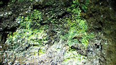
Below: Sphalerite.


Above: fluorite from the Madoc area is backed by ink-blue strontiumite and decorated with boxwork cross hatching of barite.
Left: Fluorite crystals in a fissure much as they were initially found in the great Madoc fissure.

Right: Here, limestone has been acted upon by metamorphic processes and the result is marble. Never overlook the advantage of having a fast flowing river clean the rock off for you.


Left: Pink Lady Slipper (calcophyle)
Above: Red Colombine (calcophyle)
Right: In thin soils such as on the Dark Star Claim, the bigger trees find anchorage and nourishment in the depths of a fissure.
Right: Prospectors in the Bear Lake area probe the soil to determine what lies beneath. Clearly there is a fissure here and by reading the various clues it is possible to determine the route of the fissure as it weaves through the country rock. You save yourself a lot of time and work by knowing how the trees and vegetation tell you what's beneath the soil.

Above: Ground zero for Ontario rockhounds. In this area you will find an enormous diversity of rocks and minerals as well as landscape features like skarns, pegmatites and vein dykes.

Above: Donald leads the way along the main passage beneath the dolostone caprock of the Niagara escarpment. Caves are often in a faulting region or close to larger transitional boundaries. One point though, Natural caves in limestone or dolostone are unique and priceless environments and should never be considered as a place for crystal or formation extraction. I have been a caver as long as a rockhounder and still hold the value of environmental preservation.
Below: Marc-Andre swims the water portion of the tunnels in this cave. eventually the passages dip beneath the surface and it is there that one of the only 2 successful underwater cave rescues was performed. I detail this incident in my book, "Caving in Ontario".
